EaRSLab
Earth Remote Sensing Laboratory
Human-induced global environmental changes have been occurring at an unprecedented pace and are considered as one of the main concerns to the long-term human life sustainability. Key ecological, biogeochemical and biogeophysical processes have been altered mainly as a result of human population growth and consumption, energy use, land use changes, and pollution, which in turn are affecting the components of the Earth system (atmosphere, hydrosphere, lithosphere, cryosphere, biosphere, and pedosphere).
Assessing and understanding how the magnitude and increasing rate of these factors are impacting natural systems and human societies has become a pressing need. Observing the Earth’s surface and atmosphere using remote sensing technology constitute the most relevant way for providing information on Earth physical, chemical and biological systems at local, regional, and global scales. Remote sensing provides advanced technology able to monitor and quantify how, when and where the Earth system and its resources are changing across the globe for long periods of time, in an effective, synoptic, systematic and consistent way.
Aware of the challenges imposed by the fast-growing number and diversity of platforms and instruments in remote sensing field, as well as the technological, methodological and computational advances, the Earth Remote Sensing Laboratory (EaRS Lab) brings together a multidisciplinary team to promote and conduct applied research in cutting-edge remote sensing, modelling and geo-computation methodologies for a better understanding of the global environmental changes, risks and its impacts on Earth’s systems. Furthermore, with the evident increasing trend in new satellite missions, the technological advances in remote sensing field in general, and in particular the large amount of Earth observation data contained in satellite and in-situ sensor archives, the need for training and preparing the next generation of remote sensing scientists is emerging over the geoscience community. As such, the EaRSLab’s mission is:
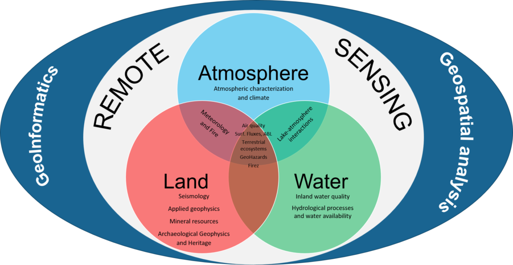
1. Increase the excellence in Earth remote sensing research by focusing in three key application areas:
- Atmosphere
- Water
- Land
2. Develop a remote sensing program designed for training, preparing, and equipping the next generation of remote sensing scientists, by collaborating in:
- Graduation programs;
- Master programs;
- PhD programs;
- Thematic Summer schools;
- Workshops;
- Other courses